Pacific Island Project wins United Nations Award
The United Nations has recognised the ‘Mapping Exposure to Sea Level Rise in the Pacific Islands’ Project as a leading initiative dealing with climate change. Jessica Purbrick-Herbst from CRC for Spatial Information explains.
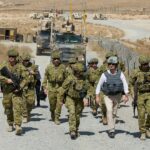
This collaborative Project with NGIS Australia and the Department of Foreign Affairs and Trade allows the Pacific Islands – Tonga, Samoa, Vanuatu and Papua New Guinea – to prepare for and adapt to sea level rise brought about by climate change.
The CRC for Spatial Information (CRCSI) brought its technical expertise and connections to the spatial industry to deliver a fit-for-purpose innovative solution to the project.
The project provides the fundamental data, skills and tools at-risk communities need to make planning decisions. It trains government decision makers to use online tools and flood maps to understand and mitigate the risks of sea level rise. Using these maps, governments can better understand and communicate climate change risk to local communities and put adaptation plans in place.
The online mapping tools have received international recognition, first by Google at the White House Climate Data Initiative and now by the United Nations Climate Change Secretariat for COP21 in Paris in December.
Using an online interactive Vanuatu Globe provided LiDAR, aerial imagery and flood information to “at-risk” communities in the Pacific. Importantly, it also built the GIS capacity and skills of local practitioners to use the data to understand risks from sea level rise.
Earlier this year the CRCSI and NGIS Australia were able to respond to the Cyclone Pam recovery by adapting the Vanuatu Globe. Out of the Globe the Crisis Map was born which enabled people to easily obtain critical data in the post-cyclone Pam recovery.
“The online map generated over 1000 hits per day at its peak. With close links to the Pacific community the CRCSI hopes to continue to bring its expertise to countries tackling the issue of climate change”, said Dr Peter Woodgate, CEO of the CRCSI.
Here are some key facts to summarise:
- More than 10 000 buildings identified at high risk of inundation within 80 years including schools, hospitals and critical infrastructure
- 195 people from the governments of Tonga, Samoa, Vanuatu and Papua New Guinea were trained on how to manage and use LiDAR data
- The Vanuatu Globe was a ground breaking Open Data portal produced for the Vanuatu Government and set a new precedent for publicly sharing elevation and sea level rise information
- Through the Vanuatu Globe, the project was able to help the 2015 Cyclone Pam recovery by providing critical map information which was accessed by more than 1000 people a day within days of the cyclone. The Globe brought together data from over 200 organisations.
And finally some words about the Momentum for Change Award:
Revealed on 27 October 2015 in London, 16 game-changing initiatives from around the world were announced as winners of a prestigious United Nations Climate Change award, The Lighthouse Award.
The Momentum for Change initiative is spearheaded by the United Nations Climate Change secretariat to shine a light on some of the most innovative, scalable and replicable examples of what people are doing to address climate change.
Momentum for Change is part of wider efforts to mobilise action and ambition as national governments work toward adopting a new universal climate agreement in Paris, France, at the end of the year.
The 2015 Lighthouse Activities were selected by an international advisory panel as part of the Momentum for Change initiative, which is implemented with the support of the Bill & Melinda Gates Foundation and The Rockefeller Foundation, and operates in partnership with the World Economic Forum and the Global e-Sustainability Initiative.
“The 2015 Momentum for Change Lighthouse Activities comprise an impressive range of projects and personal stories that touch on sustainability, climate protection, environmental consciousness and social responsibility”, said Teresa Ribera Rodriguez, Chair of the Momentum for Change Advisory Panel. “With a record number of applications – more than 450 – this year, the Advisory Panel had a difficult time selecting the best of the best”.
Read more about the Mapping Exposure to Sea Level Rise in the Pacific Island Project here.
Jessica Purbrick-Herbst is Communication Manager for the CRC for Spatial Information. She is a marketing communication specialist who brings experience from Australia, Europe and the United States. She has a focus on integrated marketing communication, brand building and awareness, and content management. With a background in agribusiness, communication technologies start-up enterprises and the social enterprise marketplace, Jessica is an influencer within business development and leadership working with the people behind the business to find voice, purpose and the practical channels for increasing internal buy-in and opportunities for growth. Jessica is the author of the irregular blog Three Actions to Implement – snappy tips on integrated marketing communication – and writes monthly on parenting tweens at Tweens Between. In 2012, she established Vibrant Australia, an online community to map the creation of change across regional Australia through enriched opportunities in employment, cultural experience and wealth. jpurbrickherbst@crcsi.com.au