How ‘citizen science’ can help save our beaches
Each and every stretch of coastline behaves differently and while some beaches continue to collect sand, others lose it and erode over time.
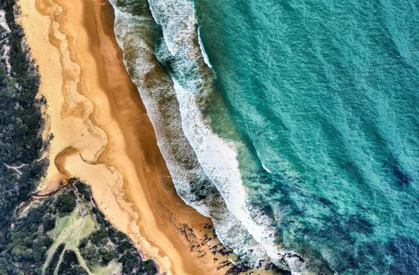
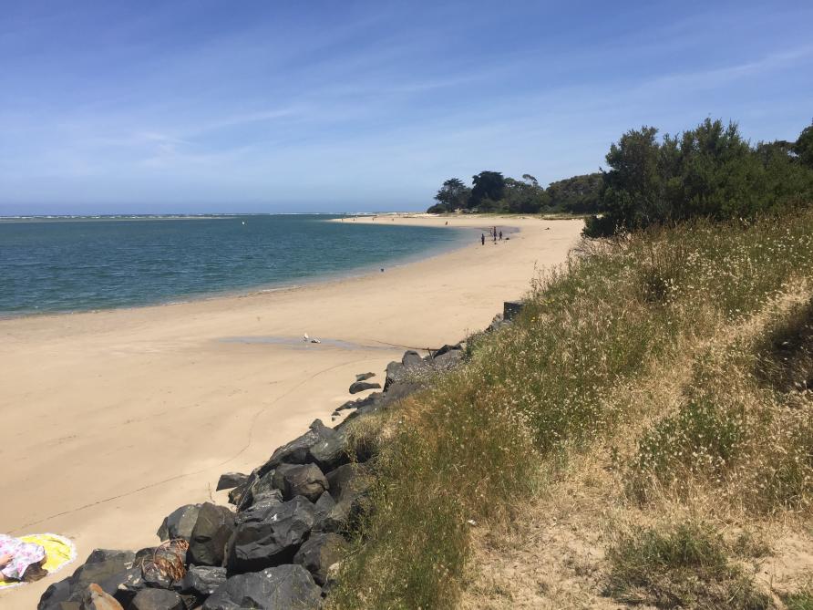
Inverloch on the Victorian coast, site of the first CoastSnap citizen science installation.
This erosion of our beaches can be the result of everyday processes like the action of the waves against the shore, but it can also be caused by events like high-energy storms that attack the coast.
Continued erosion can lead to the shoreline receding, which is of particular concern for anyone living in coastal towns and villages.
So, monitoring what is happening on our coasts is an important part of understanding and managing these areas.
But it is a long-term, data intensive process that can be difficult to complete without a team of people who can regularly repeat surveys of these areas – recording vast amounts of information like the shape and position of the shoreline or the width of the beach at high tide.
But this is where you can help. We’re asking for Australia’s citizen-scientists to step in.
Citizen-scientists can help to conduct research in the name of science, collecting far more information than a single scientist can. And a large group of citizens can help to collect even more data, helping us to understand the behaviour beaches over time.
The CoastSnap project is a community-based beach monitoring program, with citizen-scientists at the heart.
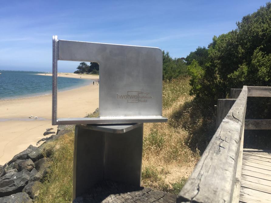
The metal cradle where citizen scientists need to rest their mobile phones when taking a photo for research.
The project uses strategically placed smart-phone cradles to collect images of a stretch of coastline, taken by members of the public. Using the cradle means that the photographs are taken at a consistent location and angle, meaning that once collated, they provide a time lapse of the coast that can be used to analyse how it changes over time.
The photographs can be submitted via the CoastSnapVIC Facebook page, via twitter using the hashtag #CoastSnapInverloch or via email at coastsnapvic@gmail.com.
Whichever media is used, please include the hashtag #CoastSnapInverloch so that when the project is expanded to more sites across the state of Victoria, we can identify which site the photograph was taken from.
Please also include the date and time the photo was taken, if you’re not sharing it straight away, as we use this data to identify what the tide level is.
From the photographs, we can then investigate how the shoreline position and beach width changes over time and identify patterns in the coast’s behaviour.
The CoastSnap project was originally led by Dr Mitchell Harley from the Water Research Laboratory at the University of New South Wales, in collaboration with The NSW Department of Planning, Industry and Environment. The first two installations were at the beaches in North Narrabeen and Manly, where over the seven-month pilot period a total of 272 and 128 photographs respectively were contributed by the community.
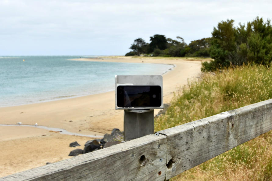
The CoastSnap cradle with mobile phone in place.
Now, with funding provided by the School of Geography at the University of Melbourne, the first CoastSnap station in Victoria has been installed.
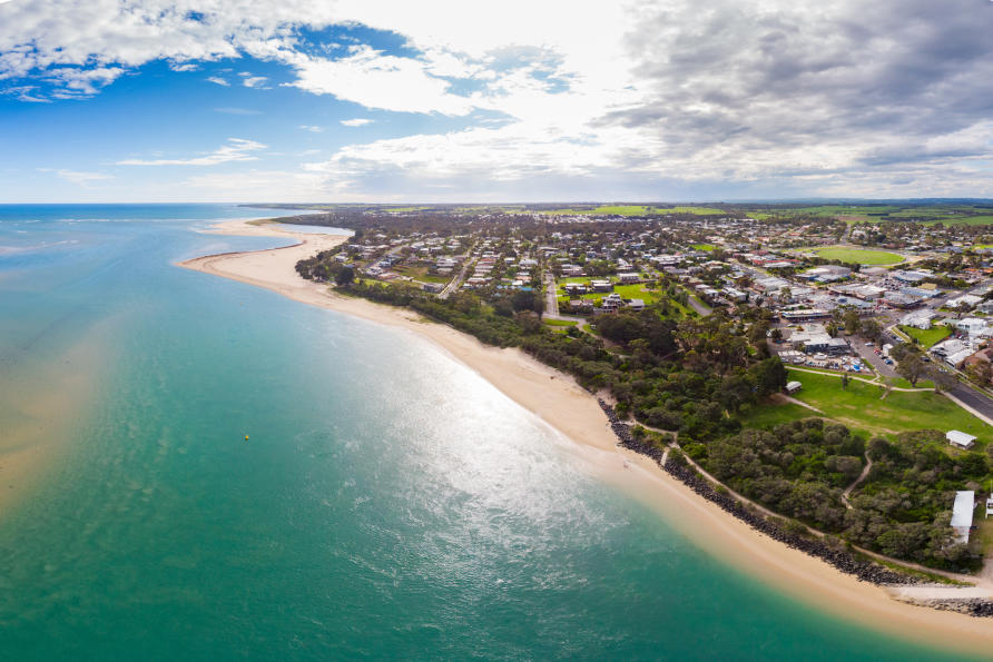
This first station is situated along The Glade foreshore in the coastal town of Inverloch, at the eastern end of Victoria’s coastline.
Inverloch is a priority site for the Victorian Government, having shown trends of increasing erosion and longshore sediment movement over the last seven years.
The area has made several appearances in the media in recent years, following the story of the eroding Surf Beach, the relocation of the Life Saving tower and the build-up of sand at the entrance to Anderson’s Inlet.
Now, the State Government has committed $AU1.15 million for a Local Coastal Hazard Assessment and Community Resilience plan, as well as for the implementation of short-term emergency works.
With the help of citizen-scientists and the CoastSnap station, collecting frequent images of Inverloch’s coastline will help to inform how it is behaving and changing over time.
It will also give insight into patterns of change and the processes or environmental conditions – like storms – that could influence these changes.
The beach at Inverloch, where the citizen scientists will help inform strategies for making the coastline more resilient.
Ultimately, this information will help to inform what Inverloch’s coastline could look like in the future, as well as support strategies that could help build resilience in this dynamic system.
While Inverloch is the site of the first CoastSnap station in Victoria, there are plans to expand this program with support from the University of Melbourne, Deakin University, the Virtual Centre for Climate Change Innovation and the Department of Environment, Land, Water and Planning. The more stations we can install, the more beaches we can monitor along the Victorian coast.
So, if you are a budding citizen-scientist, and you’re in and around Inverloch over the summer break, pick up your smart-phones and head to our CoastSnap station.
Become part of the ever-growing team of scientists who are helping us to better understand how the beaches we are so familiar with can change at the crash of a wave and the hit of a storm.
Click here for more information about getting involved in CoastSnap. This article was published by Pursuit.
Chloe is a coastal geomorphologist and numerical modeler at the University of Melbourne who studies the medium- to long-term behaviour of coastal environments through advanced modelling techniques.